 Catalogue PIGMA
University of Athens
Type of resources
Topics
Keywords
Contact for the resource
Provided by
Years
Formats
Representation types
-
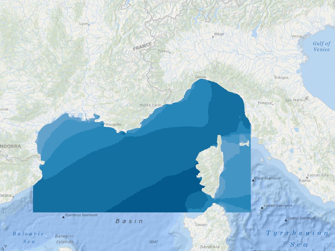
The main aim of this product was to define the suitability of offshore sites in the area between the borders of France-Spain-Italy for wind farm development. The adopted approach classifies wind speed data by their level of suitability, ranging from a grade 5 for exclusion zones, to a grade 1 for areas deemed appropriate for wind farm development. The quality indexes adopted were based on mean and variation statistical measures taking into consideration both the expected energy potential and the corresponding variability.
-
Today's normative and regulatory requirements to assess the producible energy from wind rely on in situ measurements (mast with anemometric sensors), which are extremely costly to Implement offshore. However, proof should be provided that hindcast model results are highly reliable, in order to provide an equivalent assessment. Very high resolution models is also the key issue in decision making for a proper siting that is relaying on the consistency of all datasets provided in the assessment. In this tender the products of the FP7 MARINA project will be used. 10-year (2001-2010) highresolution atmospheric, wave, tidal and ocean current simulations will be used. The model outputs are at high resolution (0.05x0.05 degree horizontal resolution, 1-hour time resolution, 5-vertical levels at 10,40,80,120,180 m). The wave parameters are co-located with the meteorological output fields. Satellite altimetry data from ENVISAT and JASON satellites have been assimilated in the system. Other wind and wave satellite data sets will be also analyzed (Synthetic Aperture Radars-SAR for example). At the same co-located points the tidal and ocean current data together with bathymetry are available. For preselected points in the North Western Mediterranean (Spain-France-ltaly areas) directional wave spectra data have been saved and are available. From SKIRON meteorological model available parameters are: WIND SPEED (m/s), WIND DIRECTION (deg), AIR PRESSURE (hPa), AIR DENSITY (Kgr/m3), TEMPERATURE (K), MODEL SEAMASK From the wave model available parameters: SIGNIFICANT WAVE HEIGHT (m), MEAN WAVE DIRECTION (deg), WAVE MEAN PERIOD (s), PEAK WAVE PRERIOD (s), SWELL WAVE HEIGHT (m), MEAN SWELL PERIOD (s), MEAN DIRECTIONAL SPREAD, WINDSEA MEAN DIRECTIONAL SPREAD, SWELL MEAN DIRECTIONAL SPREAD, MAXIMUM WAVE HEIGHT (m)
-
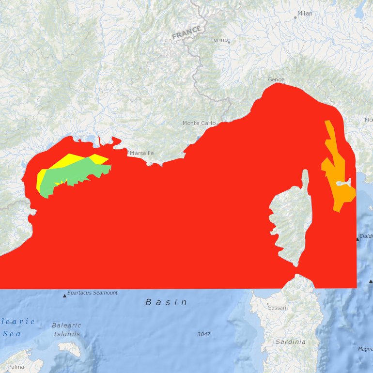
Suitability index of a wind farm in the NWMed concerning the environmental resources, the natural barriers, human activities, MPA and fisheries.
-
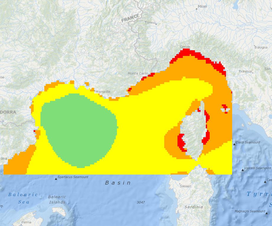
The main aim of this product was to define the suitability of offshore sites in the area between the borders of France-Spain-Italy for wind farm development. The adopted approach classifies wind speed data by their level of suitability, ranging from a grade 5 for exclusion zones, to a grade 1 for areas deemed appropriate for wind farm development. The quality indexes adopted were based on mean and variation statistical measures taking into consideration both the expected energy potential and the corresponding variability.